
THANK YOU FOR SUBSCRIBING

Technology to Facilitate Business
× 
Applied Technology Review Weekly Brief
Be first to read the latest tech news, Industry Leader's Insights, and CIO interviews of medium and large enterprises exclusively from Applied Technology Review
Applied Technology Review: Specials Magazine

In 1977, a young Robert L. Young learned surveying the traditional way, with survey flat chains a huge brass plumb bob on his belt, notebooks smudged with graphite, and hand-drafted maps. His career began when precision depended on patience, teamwork, and long days under a Texas sun. As technology advanced, Young adapted. Today, he leads Trans Texas Surveying and Mapping in North-Central Texas, where his team builds high-fidelity digital twins using advanced terrestrial and airborne LiDAR. From hand-drawn maps to data models, Young’s journey mirrors the industry’s transformation and shows how experience and innovation can redefine what a surveying firm can achieve. “I came in pulling a steel chain and doing everything with a pencil and an eraser,” he says. “Now I’m making digital twins.” South of the Dallas-Fort Worth area, the company operates with a small but skilled team focusing on complex projects where accuracy and defensibility matter most. Engineers and other land surveyor make up much of its client base, bringing high expectations and tight deadlines. The firm answers with precision, speed, and integrity—values that guide its work. FROM ANALOG ROOTS TO DIGITAL TWINS Young’s story reads like a living timeline of modern surveying. He remembers the first calculators, the heavy computers, and the early days of typing commands into DOS prompts. Yet the real change was not in the machines. It was in the mindset that came with them. He learned to treat tools as instruments, measure twice and check again, and respect the difference between adjusting and manipulating data. Those lessons built the foundation for Trans Texas, a company that greets every new technology with curiosity but also with caution. That discipline is visible in the way the firm uses its tools. For terrestrial work, Trans Texas relies on the Leica RTC360, a scanner known for its speed and precision. The team flies a RIEGL Mini 3 for airborne mapping, which performs exceptionally well around rail corridors and busy rights-of-way. When a project demands quick results and efficient costs, the DJI L2 and P1 camera offers a balanced solution.

Geo Satcom Solution
Founded on the principle of customer-centric innovation, UltiSat provides a complete portfolio of remote connectivity solutions tailored to the unique demands of high-consequence missions. For over 30 years, the company has delivered cutting-edge, resilient communications to organizations operating in some of the world's most challenging environments. Its clients range from defense and civilian government agencies to humanitarian aid organizations and critical infrastructure providers. Rapidly emerging new communications technologies, including 5G wireless networks and new low Earth orbit (LEO) satellite constellations, offer promising capabilities for remote users. But separating marketing hype from mission readiness can be a challenge. “We specialize in providing field-proven connectivity solutions for missions that demand the highest levels of performance and security," says David Myers, president and CEO of UltiSat. UltiSat’s ability to engineer bespoke solutions in-house — including satellite, wireless and terrestrial technologies — sets it apart in the market. The company takes a vendor-neutral approach, evaluating the best technology for the mission of developing a tailor-made solution. UltiSat solutions encompass initial design, complete remote equipment, connectivity, user bandwidth, field installation and 24/7 live support. The company’s value proposition is its Unified Multi-path Connectivity™ (UMC) approach. It intelligently combines multiple satellite, wireless and wired technologies into a seamless, high-reliability connection for real-time situational awareness, operational decision-making and personnel safety. This is enabled by UltiSat's Sigma Gemini™ appliance, that optimizes throughput and resiliency through advance software defined networking. For clients operating in remote or contested locations, this type of multi-path reliability is paramount.

Robotic Aerial Security Solution
When the line between safety and vulnerability blurs in the blink of an eye, first responders rise to the challenge, braving chaos to protect lives and property. But even the most dedicated teams have their limits-distance, availability and safety concerns can hinder effective action. What if the next evolution in safety didn’t arrive in an emergency vehicle? Nightingale Security is bringing this possibility to life. Its autonomous aerial security systems redefine rapid response by merging speed, foresight and precision. Intelligent drones provide real-time surveillance when human presence isn’t feasible, covering vast areas swiftly and ensuring no critical angle goes unmonitored. The drones serve as powerful force multipliers, enhancing the effectiveness of security teams and integrating into operations across commercial facilities, critical infrastructure, educational institutions and emergency response scenarios. “Just as physical security is a team sport, our technology unites the right players, expertise and technology, through our drone as first responder (DFR) capabilities. This synergy delivers a level of security that transcends the limits of traffic or terrain,” says Jack Wu, CEO. Nightingale’s drones also work harmoniously with a network of advanced sensors and systems. Motion detectors, thermal cameras and other smart technologies act as the eyes and ears on the ground, instantly triggering drones to respond to potential threats. This integration creates seamless coordination between Nightingale’s autonomous aerial systems and the broader security infrastructure, delivering a unified, efficient, responsive and safe network. Reflecting on the importance of these advancements, NYPD Interim Commissioner Donlon notes, “We are at the forefront of these exciting innovations today, and we must always keep seeking out the benefits of new and improving technology. DFR program is part of this evolution. It enables our highly trained officers to be even more responsive to the people we serve and to carry out the NYPD’s critical work in ways that are increasingly effective, efficient and safe for everyone.” Ever-Vigilant, Ever-Ready With an alarm or 911 call, the autonomous threat response system activates, dispatching a drone within seconds. Live video is streamed directly to the security team, providing immediate access to critical information like suspect descriptions, vehicle movements and potential hazards. Real-time insight allows responders to understand the situation before they arrive, enabling quick and effective action. “Saving time means saving lives. It’s not just about getting eyes on the situation quickly but arriving with the information needed to act decisively. Often, the mere presence of a drone serves as a deterrent, signaling to suspects that their actions are already under surveillance,” says Jack. The advantage is particularly vital in active shooter incidents. Integrated with gunshot detection systems, DFR drones provide law enforcement with an aerial perspective to assess the scene before entry, enhancing safety for both officers and civilians. In fire emergencies or mass casualty events, drones offer aerial views that identify injuries, vehicle damage and other hazards. They scan buildings to pinpoint individuals needing rescue and send emergency teams directly to their locations. This capability has become an integral part of modern crime-fighting strategies. “This is now part of our crime-fighting apparatus, and it is truly a game changer,” says NYPD Deputy Commissioner of Operations Kaz Daughtry.
CXO INSIGHTS

Existing Subsurface Utilities in 3D
Joseph Romano, Principal, Surveying and Mapping, Langan Engineering

Driving Digital Innovation in Architecture and Engineering
Michael Warren, Digital Growth Lead, AECOM [NYSE: ACM]

Embracing Technology for Construction Innovation
Dave Mueller, Director of VDC, Stellar

Why You Need Intervention AI: A View from Manufacturing and Operations
Martin R. Gonzalez, PhD, Senior Manager, Refining Technology, BP [NYSE: BP]

Mass Timber: A Sustainable Approach to Modern Construction
Pete Kobelt, Director, Mass Timber Solutions, STO Building Group

A Strategic Approach to Digital Success
Todd Williams, Director, Digital Platforms, CRB

The Urgent Need for Integrated Physical and Cybersecurity Teams
Casper Eloff, M.Sc. MBA. CSMP, Head of Corporate Security, the Mosaic Company [NYSE: MOS]


IN FOCUS

Data Processing in Aerial Surveys: Turning Raw Imagery into Actionable Geospatial Insights
Aerial surveys transform raw imagery into actionable geospatial insights, supporting urban planning, environmental monitoring, and disaster response through advanced data processing and quality assurance techniques.
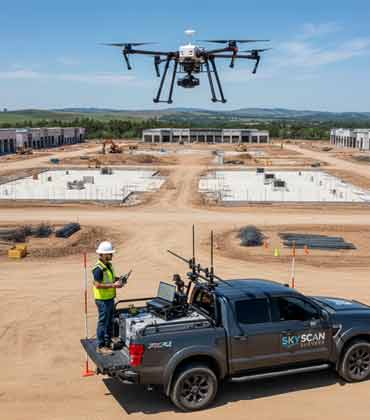
The Industrialisation of Drone Photogrammetry
The geospatial industry is evolving with UAVs and advanced photogrammetry, enabling accurate 3D modeling from drone imagery, enhancing speed and precision in spatial data applications.
EDITORIAL
Data from the Sky Boosting Operational Progress
A new era of aerial intelligence is reshaping how large and complex project environments are captured and understood. Advancements in high-resolution imaging sensors and automated flight planning are enabling expansive sites such as construction zones, mining areas and environmental regions to be documented with unprecedented speed and detail. Real-time data analytics and geospatial mapping tools turn millions of data points into actionable insights, helping teams detect challenges earlier and allocate resources more effectively.
What once required extensive manual effort can now be visualized as accurate digital models, powered by AI-based photogrammetry and 3D terrain reconstruction. Predictive analytics strengthens safety management by revealing early warning indicators, while cloud-based platforms support seamless collaboration among field and remote teams. With these technologies integrated into daily operations, efficiency increases, delays diminish, and measurable progress becomes easier to maintain from planning to completion.
This edition of Applied Technology Review highlights solutions that improve safety, accelerate timelines, enhance accuracy, and empower stronger decision-making across large and complex project environments.
This edition features leaders shaping the future of technological advancement across complex industrial environments. Judith Rivera, Global Applied Technologies Optimization Manager at Syngenta, highlights how integrated intelligent systems and human expertise are redefining seed research, enabling faster innovation and more resilient scientific progress. Jeff Green, Chief Information Officer at STRIKE, emphasizes the critical role of digital document management in strengthening safety, coordination, and performance across demanding construction operations.
The cover features Trans Texas Surveying and Mapping, where decades of hands-on experience meet the possibilities of modern digital surveying. Under the guidance of Robert L. Young, the firm blends deep craftsmanship with advanced LiDAR technologies, creating reliable digital twins that help clients see projects clearly and make decisions with confidence.
We hope this edition offers meaningful insight into how advanced field intelligence and technology-driven practices are strengthening precision, safety and efficiency across demanding project settings.

Top
