

THANK YOU FOR SUBSCRIBING

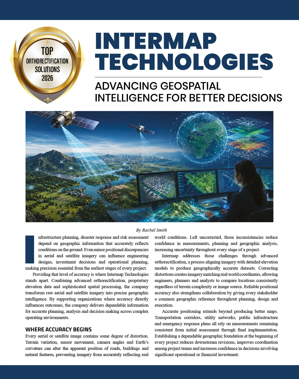
Infrastructure planning, disaster response and risk assessment depend on geographic information that accurately reflects conditions on the ground. Even minor positional discrepancies in aerial and satellite imagery can influence engineering designs, investment decisions and operational planning, making precision essential from the earliest stages of every project.
Providing that level of accuracy is where Intermap Technologies stands apart. Combining advanced orthorectification, proprietary elevation data and sophisticated spatial processing, the company transforms raw aerial and satellite imagery into precise geographic intelligence. By supporting organizations where accuracy directly influences outcomes, the company delivers dependable information for accurate planning, analysis and decision making across complex operating environments.
Where Accuracy Begins
Every aerial or satellite image contains some degree of distortion. Terrain variation, sensor movement, camera angles and Earth's curvature can alter the apparent position of roads, buildings and natural features, preventing imagery from accurately reflecting real world conditions. Left uncorrected, those inconsistencies reduce confidence in measurements, planning and geographic analysis, increasing uncertainty throughout every stage of a project.
Intermap addresses those challenges through advanced orthorectification, a process aligning imagery with detailed elevation models to produce geographically accurate datasets. Correcting distortions creates imagery matching real world coordinates, allowing engineers, planners and analysts to compare locations consistently regardless of terrain complexity or image source. Reliable positional accuracy also strengthens collaboration by giving every stakeholder a common geographic reference throughout planning, design and execution.
Accurate positioning extends beyond producing better maps. Transportation corridors, utility networks, public infrastructure and emergency response plans all rely on measurements remaining consistent from initial assessment through final implementation. Establishing a dependable geographic foundation at the beginning of every project reduces downstream revisions, improves coordination among project teams and increases confidence in decisions involving significant operational or financial investment.
Positional accuracy, however, represents only one part of understanding the physical world. Organizations also need meaningful insight into how landscapes influence infrastructure performance, environmental conditions and future development opportunities.
Providing that level of accuracy is where Intermap Technologies stands apart. Combining advanced orthorectification, proprietary elevation data and sophisticated spatial processing, the company transforms raw aerial and satellite imagery into precise geographic intelligence. By supporting organizations where accuracy directly influences outcomes, the company delivers dependable information for accurate planning, analysis and decision making across complex operating environments.
Where Accuracy Begins
Every aerial or satellite image contains some degree of distortion. Terrain variation, sensor movement, camera angles and Earth's curvature can alter the apparent position of roads, buildings and natural features, preventing imagery from accurately reflecting real world conditions. Left uncorrected, those inconsistencies reduce confidence in measurements, planning and geographic analysis, increasing uncertainty throughout every stage of a project.
Intermap addresses those challenges through advanced orthorectification, a process aligning imagery with detailed elevation models to produce geographically accurate datasets. Correcting distortions creates imagery matching real world coordinates, allowing engineers, planners and analysts to compare locations consistently regardless of terrain complexity or image source. Reliable positional accuracy also strengthens collaboration by giving every stakeholder a common geographic reference throughout planning, design and execution.
Accurate positioning extends beyond producing better maps. Transportation corridors, utility networks, public infrastructure and emergency response plans all rely on measurements remaining consistent from initial assessment through final implementation. Establishing a dependable geographic foundation at the beginning of every project reduces downstream revisions, improves coordination among project teams and increases confidence in decisions involving significant operational or financial investment.
Positional accuracy, however, represents only one part of understanding the physical world. Organizations also need meaningful insight into how landscapes influence infrastructure performance, environmental conditions and future development opportunities.
Beyond Position to Perspective
Understanding the landscape requires more than accurate imagery. Variations in elevation influence drainage patterns, flood exposure, slope stability and route selection, making detailed terrain information essential for projects extending beyond basic mapping. By combining orthorectified imagery with proprietary elevation data, Intermap provides a more complete view of the physical environment, supporting infrastructure planning, environmental assessment and long-term development.
Maintaining that level of accuracy across large geographic areas is equally important. National mapping programs, infrastructure modernization initiatives and enterprise planning efforts depend on standardized elevation data that remains consistent across regions and operating environments. It delivers dependable geographic information that enables organizations to evaluate assets, compare locations and coordinate decisions using a common spatial reference.
Consistency becomes increasingly valuable as projects expand across cities, regions and national boundaries. Different acquisition methods, changing landscapes and varied terrain conditions often introduce inconsistencies capable of limiting collaboration among organizations working from multiple datasets.
Intermap overcomes those challenges through rigorous quality assurance, advanced automation and standardized production methodologies, delivering geographic information maintaining accuracy regardless of source or location. Customers benefit from dependable datasets supporting collaboration across agencies, engineering teams and enterprise systems without sacrificing precision as projects increase in scale.
Turning Data into Operational Value
Accurate geographic intelligence delivers its greatest value when organizations can act on information with confidence. Intermap helps customers identify site constraints, evaluate development alternatives and understand physical conditions before construction or implementation begins. Access to dependable terrain and imagery data reduces uncertainty during planning, supports more efficient resource allocation and minimizes costly revisions throughout the project lifecycle.
The same foundation supports complex infrastructure operating across diverse environments. Transportation planners evaluate corridors with greater precision, telecommunications providers optimize tower placement and network coverage, while utility organizations strengthen transmission planning, asset monitoring and modernization initiatives. Delivering standardized geographic information across projects enables Intermap to improve coordination among engineering teams and support consistent decision making from planning through execution.
Reliable location intelligence also strengthens risk management and long-term resilience. Intermap's elevation data enhances catastrophe modeling, property assessment and flood analysis by providing a clearer understanding of terrain conditions influencing exposure. Engineering firms use those insights to compare design alternatives and identify geographic constraints early, reducing project risk before significant investments are made.
Public agencies and environmental organizations rely on the same geographic foundation to support land administration, emergency preparedness, watershed analysis and natural hazard assessment. Working from consistent spatial information improves collaboration across departments, accelerates response planning and helps decision makers prioritize investments with a clearer understanding of changing environmental conditions.
The Future of Geographic Intelligence
Across every application, Intermap transforms precise geographic data into practical intelligence supporting decisions that are more informed. Its orthorectified imagery, proprietary elevation data and spatial analysis help organizations evaluate infrastructure, reduce uncertainty and coordinate complex projects with greater consistency from planning through execution. The company enables customers to work from a common geographic reference, improving collaboration across engineering teams, government agencies and enterprise operations while strengthening long-term resilience.
Growing adoption of digital twins, artificial intelligence and connected infrastructure continues raising expectations for geographic accuracy. Intermap supports those evolving requirements by delivering dependable geographic information capable of representing physical conditions with measurable precision, allowing organizations to build more reliable digital models, strengthen predictive analysis and improve long-term investment planning. Its elevation data supports climate adaptation initiatives by helping governments, utilities and infrastructure owners better understand flood exposure, terrain conditions and risks affecting critical assets.
Those evolving priorities reflect a broader shift toward planning strategies that increasingly depend on trusted geographic intelligence. Through advanced orthorectification, proprietary elevation data and sophisticated spatial processing, Intermap enables organizations to make informed decisions across increasingly complex operating environments.
Recognized as the Top Orthorectification Solutions 2026, Intermap Technologies continues helping organizations transform accurate location data into smarter planning, stronger resilience and better long-term outcomes.
Understanding the landscape requires more than accurate imagery. Variations in elevation influence drainage patterns, flood exposure, slope stability and route selection, making detailed terrain information essential for projects extending beyond basic mapping. By combining orthorectified imagery with proprietary elevation data, Intermap provides a more complete view of the physical environment, supporting infrastructure planning, environmental assessment and long-term development.
Maintaining that level of accuracy across large geographic areas is equally important. National mapping programs, infrastructure modernization initiatives and enterprise planning efforts depend on standardized elevation data that remains consistent across regions and operating environments. It delivers dependable geographic information that enables organizations to evaluate assets, compare locations and coordinate decisions using a common spatial reference.
Consistency becomes increasingly valuable as projects expand across cities, regions and national boundaries. Different acquisition methods, changing landscapes and varied terrain conditions often introduce inconsistencies capable of limiting collaboration among organizations working from multiple datasets.
Intermap overcomes those challenges through rigorous quality assurance, advanced automation and standardized production methodologies, delivering geographic information maintaining accuracy regardless of source or location. Customers benefit from dependable datasets supporting collaboration across agencies, engineering teams and enterprise systems without sacrificing precision as projects increase in scale.
Turning Data into Operational Value
Accurate geographic intelligence delivers its greatest value when organizations can act on information with confidence. Intermap helps customers identify site constraints, evaluate development alternatives and understand physical conditions before construction or implementation begins. Access to dependable terrain and imagery data reduces uncertainty during planning, supports more efficient resource allocation and minimizes costly revisions throughout the project lifecycle.
The same foundation supports complex infrastructure operating across diverse environments. Transportation planners evaluate corridors with greater precision, telecommunications providers optimize tower placement and network coverage, while utility organizations strengthen transmission planning, asset monitoring and modernization initiatives. Delivering standardized geographic information across projects enables Intermap to improve coordination among engineering teams and support consistent decision making from planning through execution.
Reliable location intelligence also strengthens risk management and long-term resilience. Intermap's elevation data enhances catastrophe modeling, property assessment and flood analysis by providing a clearer understanding of terrain conditions influencing exposure. Engineering firms use those insights to compare design alternatives and identify geographic constraints early, reducing project risk before significant investments are made.
Public agencies and environmental organizations rely on the same geographic foundation to support land administration, emergency preparedness, watershed analysis and natural hazard assessment. Working from consistent spatial information improves collaboration across departments, accelerates response planning and helps decision makers prioritize investments with a clearer understanding of changing environmental conditions.
The Future of Geographic Intelligence
Across every application, Intermap transforms precise geographic data into practical intelligence supporting decisions that are more informed. Its orthorectified imagery, proprietary elevation data and spatial analysis help organizations evaluate infrastructure, reduce uncertainty and coordinate complex projects with greater consistency from planning through execution. The company enables customers to work from a common geographic reference, improving collaboration across engineering teams, government agencies and enterprise operations while strengthening long-term resilience.
Growing adoption of digital twins, artificial intelligence and connected infrastructure continues raising expectations for geographic accuracy. Intermap supports those evolving requirements by delivering dependable geographic information capable of representing physical conditions with measurable precision, allowing organizations to build more reliable digital models, strengthen predictive analysis and improve long-term investment planning. Its elevation data supports climate adaptation initiatives by helping governments, utilities and infrastructure owners better understand flood exposure, terrain conditions and risks affecting critical assets.
Those evolving priorities reflect a broader shift toward planning strategies that increasingly depend on trusted geographic intelligence. Through advanced orthorectification, proprietary elevation data and sophisticated spatial processing, Intermap enables organizations to make informed decisions across increasingly complex operating environments.
Recognized as the Top Orthorectification Solutions 2026, Intermap Technologies continues helping organizations transform accurate location data into smarter planning, stronger resilience and better long-term outcomes.
|
|

Company
Intermap Technologies
Management
Patrick A. Blott, Chairman of the Board and CEO
Description
Intermap Technologies delivers geospatial intelligence solutions that transform aerial and satellite imagery into accurate spatial datasets. Its expertise in orthorectification, elevation modeling and advanced geospatial processing enables governments, infrastructure planners and enterprises to improve mapping accuracy, risk assessment and location-based decision-making.

Copyright © 2026 Applied Technology Review.All Rights Reserved
Top
